Introduction
This report serves as a template of a plan of action in the case for a snow emergency for the University of Massachusetts Amherst. This report includes a literature review of other snow evacuation plans and portions that should be included in a final evacuation plan for the University. It also includes a micro-simulation with current traffic patterns and what the patterns would look like during several evacuation scenarios. This report includes results and methodology of our micro-simulation with recommendations of how to improve the current traffic patterns to yield the safest and quickest evacuation of off-campus students, faculty and staff. There are several different models of this evacuation that were run with all results included. This report was completed using data compiled from various departments on campus such as the Office of Emergency Management, Transit Services, traffic data collected from student within the Civil engineering department here on campus.
Background
Before developing an evacuation plan for a snow closure, it was essential to understand and analyze the evacuation plan that is currently in place, set by the Office of Emergency Management. In the event of snow closure, on-campus students will remain in their dorms while all non-essential employees will leave campus according to a schedule of staggered departure times. Employees are put into one of four groups according to the first letter of their last name and each group is scheduled to depart campus in 15 minute intervals leading up to the official closing time. The order of departure will be changed for each emergency closure so that no employee group is always first or last. As soon as university officials decide to close campus, an emergency alert is sent to all students and faculty, informing them of the official closing time and departure schedule. The purpose of the staggered departure is to ensure that all employees can safely leave campus in a timely manner. During the snow closure, University Police will be stationed at major intersections to keep traffic flowing smoothly. This current evacuation plan does not take into account where on campus the departing vehicles will be leaving from or their destinations.
PURPOSE
The purpose of this report is to provide a comprehensive snow evacuation plan for the University of Massachusetts Amherst for comparison of their old and current plan. The objective of this report is to give recommendation as to whether the current plan is the most effective plan possible and if not, provide ways to improve its performance. During the creation of the snow evacuation plan, there were many assumptions that needed to be made for the basis of the micro-simulation and also for the report portion. The first and most important assumption that was made was that all students residing on campus would remain on campus, therefore this plan was made for the evacuation of all off-campus students, faculty and staff. We made an assumption that this event would occur during a regular scheduled weekday, where students would not need to leave Amherst, MA and also that all faculty and staff would be located on campus at the time of announcement of the emergency. This plan is looking at the effects of traffic directly on campus and not on the surrounding area as those circumstances could potentially change the micro-simulation process. Other assumptions made were that all those leaving campus will be leaving by car and the bus system will not be in use. With these listed assumptions a test simulation model was created.
LITERATURE REVIEW
Case Studies
Washington University
Washington University sends out messages to students and faculty as evacuation is required. Afterwards students will have a designated location to come and wait for the bus to come and get evacuated. That we have seen used in other plans that we will also use is the mass use of telephones, this is already currently being used at the university. The University of Massachusetts already uses automated texts messages with concurrent emails to get information to students and faculty. Location will help students that use the public bus to transport to and from the university basis.
University of Louisville
The University of Louisville uses a system of timed evacuation which will be useful to get faculty and off-campus students off campus in a timely and organized fashion. This will give priority to different zones to get the buses circulating until all off-campus students and faculty are safely off campus. This is one of the aspect which will be implemented in the evacuation process for UMass so that it gets evacuated timely and organised fashion. For the people who are disabled, the buses on campus has the facility to accommodate.
UCLA
The UCLA has a similar plan of zones or different locations where students and faculty can go to be aided off of campus. Many locations on the UCLA campus also have one way exiting campus, this is to ensure that there are no traffic jams on the inner parts of campus. This will also be a useful tool for us in our snow evacuation plan.
Simulation-Based Models
Emergency evacuation is a historic and interactive process that attempts to mediate an overwhelmingly large demand through a limited transportation supply, funneling a traffic load to roads that were never designed with that capacity in mind. Quantifying the precise behavioral responses and travel choices of people faced with major crises is a pursuit that has occupied, and to some degree stymied, evacuation planners for decades. (Johnson and Zeigler, 1983). Planners thus turn to the tool of simulation, which can mimic the evolution of an evacuation in progress that has been subjected to various stresses and disruptions and influences.
Optimization-Based Model
Objective is typically defined as minimization of the total evacuation time, minimization of the network clearance time, or maximization of the network traffic throughput.
Spatial Planning
In developing an evacuation decision support system, Tufekci and Kisko (1991) proposed a minimax optimization model with the linear structure. This linear programming problem has the flow conservation constraints for each origin destination (O-D) pair and the inequality constraints indicating that the travel time of each link must be accommodated by the evacuation clearance time. The objective of this minimax problem is to minimize the network clearance time, which is defined as the maximum of all the link clearance times. The decision variables in the model, path flows, are subject to a user-equilibrium traffic assignment on the K-shortest routes for each O-D pair.
Dunn and Newton (1992) suggested an evacuation planning model with a minimum cost flow problem formulation, where the “cost” is the total evacuation time. Given a static evacuation network, the purpose of their model is to find the optimal flow pattern that minimizes the evacuation time, subject to the pre-specified flow upper limit of each link. They applied the classic out-of-kilter algorithm to solve this minimization problem.
Temporal planning
Sbayti and Mahmassani (2006) proposed an evacuation planning model to search for the optimal combination of departure time, route and destination for an evacuation network so as to minimize the network clearance time. They employed a mesoscopic traffic simulator, DYNASMART-P, to mimic the underlying traffic assignment and determine the network state, and developed an iterative heuristic procedure to approximate the optimal temporal distribution of departure times. The sequential staging policy is finally extracted from the continuous departure-time distribution. In another staged evacuation planning model, Liu et al. (2006b) focused on optimizing the starting time of each evacuation demand zone with a given demand generation rate and temporal pattern in advance. The objective of this model is to minimize the sum of total urgency-weighted evacuation time and waiting time.
Chien and Korikanthimath (2007) proposed an analytical method to model the evacuation staging process and estimate the evacuation time and delay for an evacuation corridor with a uniform demand generation distribution along the length. This method was then used to determine the optimal number of stages with an equal duration length.
Network Planning
Cova and Johnson (2003), by arguing that most traffic delays occur at intersections during an evacuation, introduced the lane-based routing strategy in evacuation planning, which is of the purpose of limiting the traffic turning movements at intersections. Given the lane-based routing requirement in their proposed model, a feasible evacuation plan must have no crossing conflict between any two directions of traffic flow throughout an intersection. In practice, such intersection control measures can be readily implemented with some temporal installations of traffic barriers and road signs as well as emergency management personnel at intersections.can be readily implemented with some temporal installations of traffic barriers and road signs as well as emergency management personnel at intersections.
Hamza-Lup et al. (2004, 2007) proposed an evacuation network and route planning model for seeking full contraflow configurations on all eligible links in an evacuation network and planning evacuation routes based on the contraflow configuration. Two simple network optimization heuristics were proposed. The first heuristic determines the lane-reversing direction of each link based on the coordinate information of the two end intersections of the link, that is, an outbound traffic direction is chosen for lane reversal, while the second one determines the lane reversal configuration and evacuation routes by searching for shortest paths from the emergency source node to all exit nodes.
Meng et al. (2008) followed a similar approach to define and solve a lane-based contraflow optimization problem. The decision variables in their model are the number of lanes for each traffic direction of the candidate links. The traffic simulator adopted to serve the lower-level problem is PARAMICS (Parallel Microscopic Simulator). A genetic algorithm was developed to search for the optimal contraflow solution and the simulator’s application programming interface (API) provides the functionality of implementing the contraflow configuration given by the upper-level decision and delivering the feedback information from the lower-level simulation results.
VISSIM Simulation
VISSIM is a time-step behavior-based simulation modeling software, used in this study to “microscopically” analyze the traffic characteristics of an area subject to evaluation; this means it breaks transportation elements and characteristics into small units. VISSIM employs the Wiedemann model, a psychophysical model that formulates patterns of driver behavior into probabilities for predicting how vehicles move and interact in a network. Wiedemann’s model allows the user of VISSIM more flexibility than other software to customize data points to be entered and mined (Bloomberg and Dale, 2000).
The software defines four different driving modes for users in the network; approaching, following, braking, and free driving (Congested Freeway Micro-Simulation Model using VISSIM Berkeley 2004). Drivers react to the behavior of other drivers when changing driving modes; this obviously presupposes acceleration, deceleration, braking and other driving behaviors. The software can even accommodate a driver's proclivity for changing lanes or tailgating. When using a microscopic traffic simulation software like VISSIM, which draws interpretations from driver behavior, one must take care not to ascribe undue big-picture significance to mere random driving events (Bloomberg and Dale, 2000). This is why VISSIM simulations should be run between 10 and 20 times in order to reach statistically valid baseline conclusions (Bloomberg and Dale, 2000)
VISSIM allows users to set the composition of vehicles in the traffic flow (VISSIM 5.30-05 User Manual, 2011). VISSIM contains six default vehicle types: car, HGV (heavy vehicles), bus, tram, bicycle, and pedestrian, plus other user-defined categories (VISSIM 5.30-05 User Manual, 2011). Care should be taken to ensure that vehicle compositions used in simulations are consistent with established models. Vehicle then can be assigned links and routes and any other optional information about traffic controls or delays. VISSIM can then be run and will provide a continuous calculation of travel times across user-defined segments throughout the simulation. (Silber, 2015)
Micro-Simulation
In order to study the effectiveness of the current snow evacuation plan and compare it to the proposed plan, a micro-simulation model was developed to obtain certain performance metrics such as delay, travel time and queue length. The microscopic traffic flow simulation program used is Vissim. This program was chosen because it is a commonly used tool for visualizing and analyzing traffic patterns on a small-scale and because it offers a way to easily replicate test results. To begin developing the model, all campus roads and intersections were assigned links and nodes using aerial GPS pictures of campus. An important aspect of creating the traffic model is determining the boundaries of the system which allows the microsimulation to focus solely on campus traffic. The UMass Amherst campus has 5 points of entry/exit that were used as the boundaries:
- North Pleasant Street (North)
- North Pleasant Street (South)
- Eastman Lane
- University Drive
- Massachusetts Avenue
Methodology
These 5 boundaries include 4 signalized intersections and 1 roundabout. Data from traffic counts for each intersection was inputted into Vissim in order to model the existing conditions with no evacuation. In the event of a snow closure, all faculty and staff are to leave campus by a certain time. Employees with vehicles park in either Lot 12 or in the campus garage, both located off of Commonwealth Avenue.
Parking Lot
A total of 6333 cars were evacuated from 19 parking lots. For each of these parking areas, the total number of parking spots was provided by the University. This data was then imported to Vissim and assigned as vehicle inputs for all the models. The program simulate the traffic flows stochastically during the event of an evacuation.
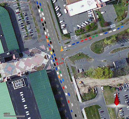
Existing Model
Goal: By creating a schedule of departure time intervals, it ensures staff and off-campus students leave in a timely manner. UMass Amherst snow evacuation plan is based on normal distributions of students based on their first or last name. For an example students last name starting with A to D leaves 60 mins before closure, E - K in 40 mins, L-Q in 20 mins, R-Z at official closing time.
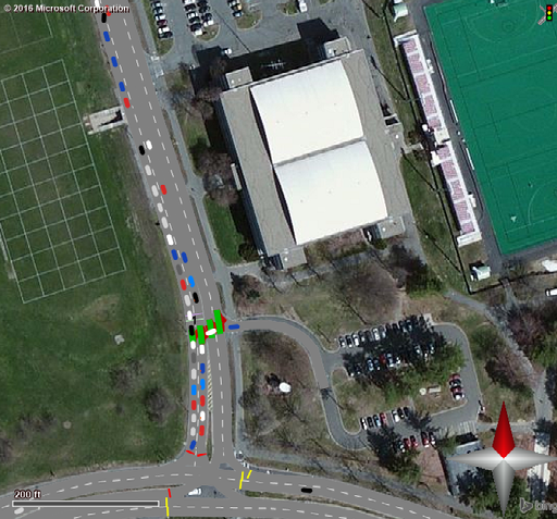
Base Model
Goal: With no schedule of departure times or traffic management strategies, it serves as a control model to compare the current and proposed plans against.
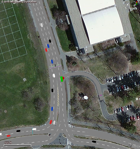
Revised Model
Goal: North Pleasant St and Commonwealth Ave become temporary one-way roads, allowing vehicles to flow freely through intersections and experience less traffic backups.
The campus is basically covered by Mass Ave in the South, North Pleasant street in the East, Governors Drive in the north and Commonwealth Avenue in the South. In our revised model we made Commonwealth Ave and North Pleasant Street as one ways. The signal timing wasn't adopted for this method.
Results
Our results clearly indicates that Revised model is better than the Existing and Base model based on 3 performance metrics i.e; delay, queuing and vehicle travel time . The time taken for all the cars in the Base model is 134 minutes. Then for Existing model it is 61 minutes and for Revised model it is about 56 minutes. The Existing model is as efficient as the Revised model. Note: If the officers mess up to regulate and control the traffic at an intersection the yield and go system at an intersection would be a complete chaos.
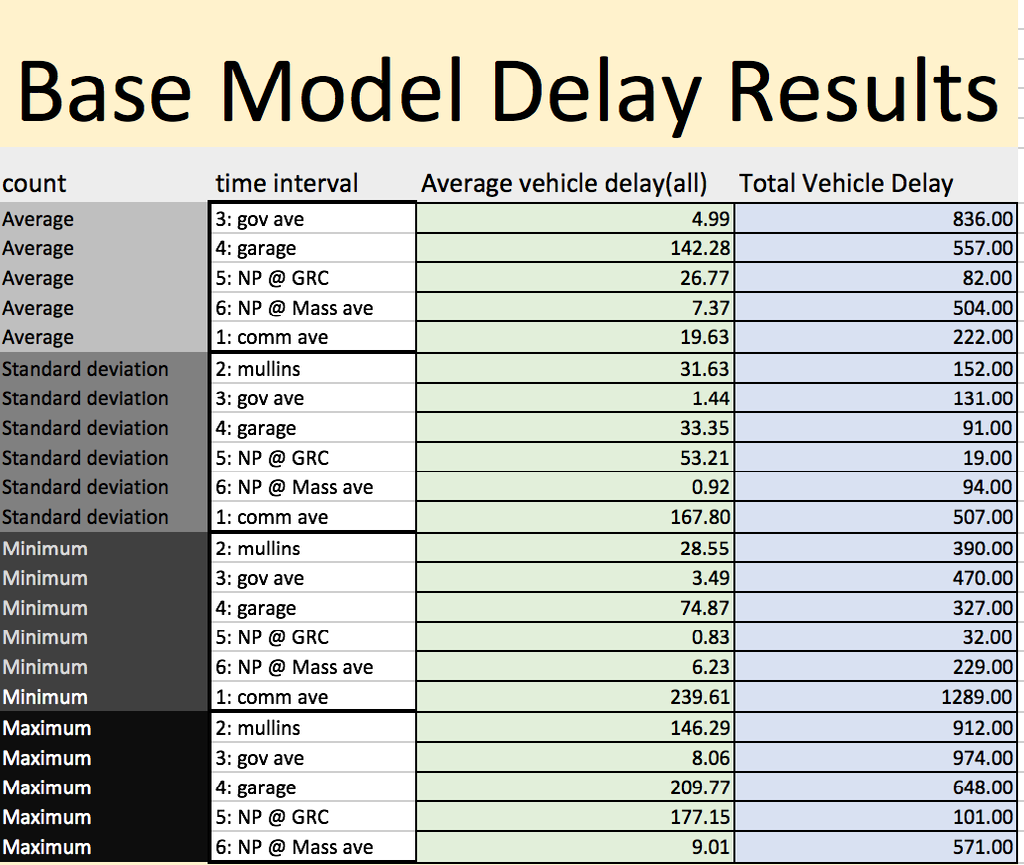
Delay Results
Queuing Results
Travel Time Results
Graphs
CONCLUSION
It was concluded based up the revised model, existing model and a base model that the current evacuation plan is in fact an efficient way of safely getting students, faculty and staff off of campus. It was proven that the staggered departure is an organized manner to evacuate off of campus should an emergency be in place. With the introduction of one-way streets on campus during an emergency it would also aid in getting students and faculty off campus quicker.
It was concluded that based upon our metrics for each of the simulations, there was a mix of improvements. On some parts of campus, our model was superior to the existing model, but in other areas, the existing model performed the better.
Our recommendation would be to continue with the staggered departure of students, faculty and staff and but also incorporate temporary one-way streets on the campus in order to improve the delays. This would be taking the best aspects of both the existing model and our simulated model. In the future, a staggered departure based on normalization of individual’s travel distance would be a good approach to research and study.
REFERENCES
- Bloomberg, Loren and Jim Dale. “A Comparison of the VISSIM and CORSIM Traffic Simulation Models.” Proc. of Institute of Transportation Engineers Annual Meeting. N.P.:n.p.,2000. N. pag. Print
- Congested Freeway Micro-Simulation Model using VISSIM Berkeley 2004
- Chien, S.I. and Korikanthimath, V.V. (2007). “Analysis and modeling of simultaneous and staged emergency evacuations.” Journal of Transportation Engineering, Vol. 133,No. 3, 190-197
- Dunn, C.E. and Newton, D. (1992). “Optimal routes in GIS and emergency planning applications.” Area, Vol. 24, No. 3, 259-267
- Hamza-Lup, G.L., Hua, K.A., Le, M. and Peng, R. (2004). “Enhancing intelligent transportation systems to improve and support homeland security.” Proceedings of the 7th IEEE Intelligent Transportation Systems Conference, Washington, DC, October 3-6, 2004.
- Johnson, J.H. and Zeigler, D.J. (1983). “Distinguishing human responses to radiological emergencies.” Economic Geography, Vol. 59, No. 4, 386-402.
- Liu, Y., Lai, X. and Chang, G.L. (2006b). “Cell-based network optimization model for staged evacuation planning under emergencies.” Transportation Research Record, No.1964, 127-135.
- Meng, Q., Khoo, H.L. and Cheu, R.L. (2008). “Microscopic traffic simulation modelbased optimization approach for the contraflow lane configuration problem.” Journal of Transportation Engineering, Vol. 134, No. 1, 41-49
- Tufekci, S. and Kisko, T.M. (1991). “Regional evacuation modeling system (REMS)
- Hannah R. Silber. (2015). “Developing a Plan to Evacuate a University Campus using Microscopic Simulation and Traffic, Demand Modeling, Master of Science
- A decision support system for emergency area evacuation.” Computers and Industrial Engineering, Vol. 21, No. 1, 89-93.
- Chie, Xie, August 8th (2008).EVACUATION NETWORK OPTIMIZATION: MODELS, SOLUTION METHODS AND APPLICATIONS
- VISSIM 5.30-05 User Manual.” PTV Vision Traffic Mobility Logistics (2011): n. pag. VISSIM 5.30-05. Planung Transport Verkehr AG Karlsruhe Germany. Web.
- Cover picture Link http://universitystaffassociation.mtasites.org/wp-content/uploads/sites/61/2016/01/coverphoto_1.jpg.