Published by the University of Southern California Sea Grant Program
November 7, 2018
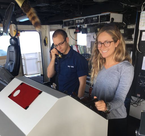
From October 4-12, 2018, the NOAA Ship Rainier welcomed aboard three graduate students for a new seafloor Mappers-in-Training Program. USC Sea Grant recruited nearly 50 applicants from around the United States, and Kwanza Johnson (Kent State University), George Snyder (University of California, Davis) and Sky Smith (University of California, Santa Cruz) were selected for the internship.
The interns spent 9 days mapping the seafloor around the Channel Islands National Marine Sanctuary, gaining experience in making seafloor maps using multibeam sonar (sound navigation and ranging) systems and processing multibeam data.
“Living and working aboard Rainier was not only a technical learning experience, but a peek into the lives of the NOAA officers, scientists, and crew members. Science at sea is remarkably different than anything I have participated in before. The technicians aboard Rainier were quick to let us join their lives and laboratories; I was constantly engaged, challenged, and impressed by what it takes to collect and process data in such a unique environment." - Sky Smith
The interns contributed in a significant way to NOAA’s ocean and coastal mapping mission and gained an understanding of how seafloor maps are used to make informed decisions about our coastal and ocean resources to support the U.S.’s blue economy.
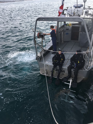
The interns quickly became integrated into the daily operations and participated in survey acquisition, ship operating procedures, and data processing. Each day, at least one intern was assigned to a survey launch where they learned how to run the multibeam sonar, acquisition software, and take CTD measurements (conductivity, temperature, and depth).
In addition, they were given a small survey sheet of Stearns Wharf in Santa Barbara. The bathymetry of this pier is of particular interest to the Rainier’s Commanding Officer, CDR Ben Evans, as a potential docking location. This assignment gave the interns ownership over the survey process and helped them better understand the effort required to collect, process and finalize seafloor data. The survey will be used to assess the most current depths of the pier to determine if the ship can safely dock there.
“Participating in the Mappers-in-Training Program was an insightful hands-on opportunity! I expanded my knowledge in various software, procedures, backscatter, and other properties involved in the collection of high quality multi-beam sonar data. My experience aboard the Rainier was a memorable one; especially in regards to the physical demands and sacrifices required for life at-sea. This internship has influenced me to continue towards future sonar (or GIS) mapping projects for marine mammals and ecosystems.” – Kwanza Johnson
“Aside from the simply stunning experience of a research cruise in the Channel Islands, my time in the [program] gave me a host of useful skills for my own research. Shipboard on the NOAA ship Rainier, I got an immersive introduction of the logistics involved with conducting ship-based science, and the best practices for multibeam bathymetry data collection. Additionally, the various agencies we met with during the [program] gave me insight into how science informs policy here in the Channel Islands region, and how ongoing research is seeking to reconcile both environmental and industrial demands.” - George Snyder
The importance of partnerships was highlighted throughout the internship and was underscored as vital to the successful planning and execution of Rainier’s mission to fill information gaps about benthic resources inside the Sanctuary.
This program was funded by National Oceanic and Atmospheric Administration (NOAA) Office of Coast Survey (OCS), Office of Marine and Aviation Operations (OMAO) and Office of National Marine Sanctuaries (ONMS), and conducted in partnership with the National Centers for Coastal Ocean Science (NCCOS) and the Bureau of Ocean Energy Management (BOEM) Pacific OCS Region.
Story based on the post-internship summary by Jeremy Potter (BOEM), Chris Caldow (NOAA), Bryan Costa (NOAA), and CDR Ben Evans (NOAA). Quotes and photos used with permission. Photos provided by Rainier's officers, crew, engineers, technicians, interns and other program participants.