In 1906, the arctic explorer Dr. Frederick Cook, seen here, claimed to have made the first ascent of Denali (Mt. McKinley), the tallest peak in North America. His claim was initially endorsed by the Mazamas and an early account of his climb, The Conquest of Mount McKinley, appears in the 1907 Annual. Trouble developed when Dr. Cook claimed to have reached the North Pole in 1908, a full year before Admiral Robert Perry in 1909. Doubt concerning his North Pole claim raised questions about the validity of his having reached the summit of Mt. McKinley.
C.E. Rusk grew up in the shadow of Mt Adams and reached it summit for the first time in 1889 at the age of 18. He went on to become one of the West’s foremost mountaineers. His name is closely linked with Mt. Adams. Rusk Glacier is named after him and he made the first ascent of Mt Adams’ East Face. Rusk proposed in 1910 that the Mazamas launch an expedition, using Cook's maps, notes, and book, To the Top of the Continent, to either reach the summit or prove the claim false.
Rusk was able to convince the Mazamas to sponsor the expedition. In addition to subscriptions from members, the Mazamas were able to secure additional funding from The Pacific Monthly magazine, and The Oregonian and New York Herald newspapers. According to records of the trip, the expedition’s total expenses came to $2,200, roughly $53,000 today.
This was no small undertaking, for Rusk or the Mazamas. The expedition to Alaska almost bankrupted the organization and led to the Annual not being printed for several years due to lack of funds.
As part of the subscription, Rusk agreed to give a series of lectures using the images you see here. While the glass slides from the ear remain, sadly the copy of his narration has been lost. The narrative here draws from Rusk’s dispatches published in the Pacific Monthly magazine.
Three companions joined Rusk on the expedition. A. L. Cool was a good friend of Rusk’s from the Lake Chelan area, Joseph Ridley was a Mount Baker National Forest ranger, and Frank H. Rojec, the expedition’s photographer.
Rojec worked for the Kiser Photography Company and was well known for his pictures of Western scenery. All four men were experienced mountaineers.
The party left Portland in late April, 1910. In a record book they hoped to place on the summit of Mt. McKinley Rusk wrote,
“In the quest of truth and justice to all men aspiring to conquer what is believed to be the noblest and most difficult peak on the globe, this expedition to Mt. McKinley is undertaken by the Mazamas from Portland, Oregon, on the 25th day of April, 1910.”
Prior to their departure Rusk had written,
“Up to the present time two mountaineering parties have claimed the honor of the first ascent of Mt. McKinley. To ascertain with absolute impartiality and without prejudice to any man the truth of these conflicting claims, or to disprove them if false, is one of the objects of this expedition.”
In addition to Cook’s claim of having reached the summit in 1906, there was another summit claim made by a group of Alaskan Sourdoughs, however the later claim was widely viewed as simple barroom bluster.
The Rusk party was not alone on Mt McKinley that year. Professor Hershel Parker, of New York’s Columbia University, headed up another expedition intent on climbing the mountain as well. Throughout the dispatches published in Pacific Monthly, Rusk refers to the other party on the mountain as the Parker-Brown party.
Rusk begins his recounting thus,
“Our journey from Portland to the head of Cook Inlet was rich with interesting experiences; but though we had come nine-tenths of the distance from our starting point to the great peak, we did not feel fairly launched upon our journey until we met the mighty flood of the Susitna, rushing with resistless sweep into Cook Inlet, turning the blue of ocean into the gray of glacial drift.”
From Cook Inlet they took the sternwheeler Alice up the Susitna River to Talkeetna and the mouth of the Chulitna River. There they hired a local to guide to lead them up the Chulitna to the confluence of the Tokostina River where they established camp.
Around the 24th of May Rusk reported,
“We reached Susitna before noon. The entire population was on the bank to greet us, and revolver shots rang in the air in welcoming answer to the whistle of the steamer. The Alice was the first boat of the season, arriving on the first day that would have been possible for a watercraft to reach the little town.”
Having reached the limits of the sternwheeler Rusk and his party transitioned to a much smaller boat for the thirty mile trip up river. He wrote,
“A poling boat, thirty-two feet in length, somewhat after the fashion of a bateau, had been built especially for us in Seattle, and on this we now placed our reliance. Men experienced on these northern waters had given as their opinion that this boat would be of more service on the river than the launch Explorer, and that the later craft would have extreme difficulty in getting up the river at all. Subsequent events proved the better knowledge of the Parker-Brown party. ”
“We loaded our outfit, weighing nearly a ton, into our boat, and it sank far down into the water. The bottom was too narrow and with too little surface. This, coupled with the great length of the boat, made it unwieldy and hard to handle in the swift water. All afternoon we struggled in the sloughs along the east bank of the river, and at evening were worn out, with little progress to our credit.”
“To add to our discomfort, as we sat exhausted on the bank of the river, we were forced to see the Explorer disappear around a bend, far above, sliding almost easily up toward the region that now seemed unattainable to us.”
Rusk and his party established camp at the confluence of the Chulitna and Tokositna rivers. In a letter to fellow Mazama Charles Choles Rusk wrote,
“Dear Sholes: After six days’ battle royal with the Chulitna and Takasitna Rivers, we arrived here yesterday in good shape, and I named the place ‘Camp Rodney,’ in honor of my little boy’s birthday.”
The expedition had underestimated the amount of time it would take to reach the mountain and the amount of supplies they would need. Early on Rusk began to ration food. By the 10th of June they had established their base camp and it is with great pleasure that Rusk recalled,
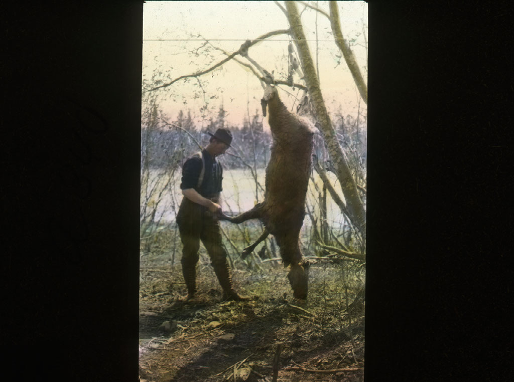
“One day, while Cool and I were at work on the trail, and Rojec and Ridley were in camp, our food supply received an unexpected addition...We had some good steaks and stews from that caribou; but most of the meat was jerked for use on the glacier.”
Knowing that they were bound to run out of food, Rusk sent their Indian guide back down the river to get more supplies and return to Camp Rodney. He never came back.
From Camp Rodney they had to bushwhack their way to the terminus of Ruth Glacier, in essence breaking trail for upwards of eight miles. At some point during this portion of the trip, it was decided that Cool would return to their base camp and await the arrival of fresh supplies. The weather at times worked against them as well. Rusk recalled,
“It rained inconsiderately and often; but we finished our trail in less than three days of actual working time.”
Upon reaching the terminus of the Ruth Glacier Rusk reported,
“Here we were beginning to feel the impress of the vast solitude, for even upon the slopes where the green grass and the willows grew, there was no life except that of the marmot, the hare and the ptarmigan. Only a dozen human beings have ever penetrated these wilds.”
“The evening we arrived at the river with our last load, after having traveled most of the day in a drizzling rain, the water was so high we could not cross."
"By morning, however, the stream had fallen so much that we waded back and forth, after stretching a rope for safety, until we had carried all of our outfit across.”
“Each day now became a repetition of the day before. After breakfast each morning we would shoulder our packs and set forth over the snow or ice or rocks, and struggle onward until some time in the afternoon when a camping place would be selected, and we would return to repeat the process on the morrow. Each third day we would move camp.”
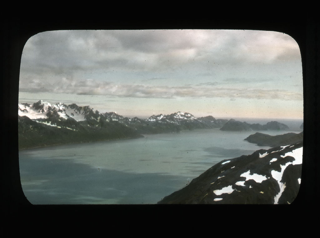
Three weeks and some thirty or forty miles up the Ruth Glacier from their basecamp, the party reached a bold promontory called Glacier Point. Here the glacier drops more than at any other place along its course, producing an ice fall that is very badly broken and crevassed. The party was entering into territory where only a few people had ever been. Rusk took it upon himself to name a few of the surrounding peaks for some of the supporters of the expedition. Rusk noted that, “Four of the peaks around the head of the tributary glacier I have named in their order from south to north, Mts. Lee, Glisan, Mazama (the peak Cook climbed), and Sholes.”
It is around this time that Rusk begins to doubt Cook’s claim.
After reaching the top of the ice fall Rusk reported,
“We rounded the last hummock of ice, after hours of toil up the broken way, and saw a great, even snow field stretching away for fifteen or twenty miles in length and two miles wide, with a roof of cloud, a floor of snow and walls of savage granite. Not a ray of green relieved the Arctic nature of the scene. Animal life there was none- nothing but gloomy, grand impressive solitude- the heavy silence occasionally startled by the crash of an avalanche.”
Traversing the snowfield was a welcome break from climbing the icefall, but it was not with it’s own danger.
“There were many crevasses in the ice below, and we proceeded for nearly a quarter of a mile with extreme caution. Rojec generally fell into a crevasse whenever we made a relay along this route; but it may be safely said that he never fell into the same one twice.”
Rusk made no mention of it at the time, and it would not be until after his death that it came to light, but at some point after cresting the icefall and making their way across the snowfield the other two members of the party conspired against Rusk. It would appear that the long days of slogging back and forth, from camp to camp, coupled with the rationed supplies pushed Rojec to the brink. Rusk told his wife many years later that Rojec had attacked him and struck him in the back of the head with a snowshoe, knocking him into a crevasse. However the blow was not enough to kill him and he recovered quickly. Rojec reportedly fell to his knees crying and begged for forgiveness. It is unknown how Rusk cajoled the two to carry on, but carry on they did.
“The head of Ruth Glacier is a great amphitheater, perhaps five miles in diameter, surrounded by high peaks from which come at least a dozen tributary feeders to form the main glacier. The peaks at the northern end are beautiful snow-capped ones, at least 12,000 feet in height, making a part of the great range of which McKinley is the culminating point.”
At this point, Rusk no longer believed Cook had McKinley. As he wrote in his article detailing the expedition, they
"realized that it would require perhaps weeks or months in which to explore a route to the summit, we realized how utterly impossible and absurd was the story of this man [Cook], who, carrying a pack, claims to have started from the mouth of the Tokositna on the eighth of September, and to have stood on the highest point of McKinley on the sixteenth of the same month. The man does not live who can perform such a feat!"
After realizing that reaching the summit of Mt McKinley was no longer possible, the party set about exploring several of the smaller mountains. At this point Rusk’s recollections become more philosophical of the land in which they travel,
“There is a profundity in immense solitude that cannot fail to impress even the most sluggish intellect. There is fascination in the untrod wilderness; a lure in the mystery of the great unconquered peak.”
“To the northwest of our camp the monstrous form of Mt. McKinley rose to a dizzy height, the summit twelve miles away in an air line. But between us and the massif of the mountain a succession of precipitous ridges barred the way.”
Of Frederick Cook, Rusk wrote,
“Originally I was a believer in Dr. Cook, and it was only when the proof of his deception became too strong to resist that I lost faith in him. I entered upon the Mt. McKinley project absolutely without prejudice against him, and would have been only too glad to have found his claims just. In many respects Cook is a remarkable man, with numerous admirable qualities. The pity of it all is that he should have spoiled a great career by his failure to resist a unique temptation.”
Rusk tried to place what they are seeing in the context of the imaginations of his readers by writing,
“Mont Blanc has been called, by a great poet, the monarch of mountains, and yet the pride of Europe might be dumped in among the crags that cluster around the imperial throne of McKinley without adding visibly to the grandeur of the scene.”
On the 15th of July Rusk noted,
“Our provisions were now practically exhausted, and with hunger ‘staring us in the face’ as explorers are wont to describe it as doing, we were forced to turn homeward....With a parting salute to Mt. McKinley, we set our faces regretfully toward base camp with thirty or thirty-five miles of hard glacier work before us.”
After two months of the mountain, they were back in base camp by the 19th, and after a quick, but hazardous run down the river, found themselves back in Susitna on the 22nd.
An analysis of the photographs collected by Rusk’s party and those taken by Cook show startling results. Rusk's photos show that images claimed by Cook to have come from the ascent, are in reality are from low elevations on the tributary glacier, some fifteen to twenty miles from Mt. Mckinley. Fittingly, the peak that Cook claimed as the summit of McKinley, Rusk named False Peak.
A quick note about this image and the next. Both are scans from Dr. Cook’s book, To the Top of the Continent, annotated in Rusk’s hand. Rusk took the book along with him on the expedition in 1910 and used the descriptions and photos to retrace Cook’s route. In the image above you can see an arrow that notes the location that Cook used for his summit photo, as seen below.
Rusk’s annotation on this page reads, “20 miles from Mt McKinley.” Rusk’s annotated copy of To the Top of the Continent is one of the more historically valuable items in the Mazama Library and Historical Collections.
We could find no record of Rusk giving a presentation upon his return. If he did the 1912 Mazama Annual, published two years after the expedition due to the financial burden the trip places on the organization, make no mention of one.
But, it is fun to imagine Rusk standing in front of a room full of supporters, using the glass lantern slides these images are taken from to share his adventure with them, as we have with you here.
For the record, The first summit belonged to an expedition led by Hudson Stuck in 1913. The first person from their team to summit was Walter Harper. Source: To the Top of Denali by Bill Sherwonit.
Citations and sources:
- VM2000.015 C.E. Rusk Collection, Mazama Library and Historical Collections
- Dr. Frederick Cook image from wikipedia
- Narrative extracted from Pacific Monthly magazine, October 1910
- Page scans from To the Top of the Continent, Mazama Library Special Collection, 917.98.C771
Credits:
Mazama Library and Historical Collections, VM2000.015 C.E. Rusk Collection